Collierville's Forest Hill area, three developments on Forest Hill-Irene Road, spans ZIP codes 38017 and 38125 and is zoned for Collierville High.
Last checked Oct. 17, 2026. Sources: the Town of Collierville’s subdivisions and developments layer and town boundary layer, Collierville Schools’ school zone locator, the Tennessee Department of Education’s 2024-25 letter grades, the Census Bureau’s ZIP code areas, the Zillow Home Value Index and OpenStreetMap.
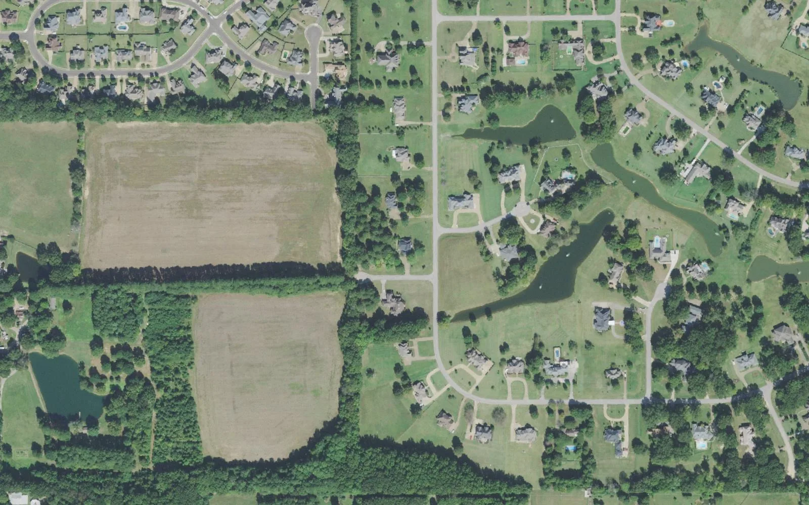
The Forest Hill area is Collierville’s southwest corner and, of the areas in this guide, the farthest from the Town Square. The town’s map names three developments here for Forest Hill: The Lakes of Forest Hill (about 219 acres), Forest Hill-Irene Estates (about 135 acres) and Forest Hill PD (about 74 acres). The aerial view shows large lots around ponds, next to fields and woods. It is the one area in this guide that crosses into a second ZIP code.
What this means for you
- High school: every point we checked is zoned for Collierville High School, with Schilling Farms Elementary and West Collierville Middle.
- Home value: Zillow’s typical value was $504,970 in ZIP code 38017 and $275,797 in ZIP code 38125 in September 2026; see below for why they differ.
- Highway: the State Route 385 interchange at Forest Hill-Irene Road is about a mile away.
Where it is
On the town’s subdivisions and developments layer, Forest Hill PD and The Lakes of Forest Hill sit along East Shelby Drive near Forest Hill-Irene Road, and Forest Hill-Irene Estates runs along East Holmes Road to the south. All three are inside the town limits on the town’s 2019 boundary layer.
ZIP codes: on the Census Bureau’s ZIP code areas, Forest Hill PD is in 38125, while Forest Hill-Irene Estates and nearly all of The Lakes of Forest Hill are in 38017. The town limits, not the ZIP code, decide which city taxes and serves a home. See property taxes.
The town’s layer does not show homeowners associations. To find out whether one covers a lot, check the deed and the recorded plat with the Shelby County Register of Deeds.
Schools
All 86 points we checked across the three developments in the district’s zone locator returned the same three schools:
| School | Address | Grades | 2024-25 state grade |
|---|---|---|---|
| Schilling Farms Elementary | 935 Colbert St. | K-5 | A |
| West Collierville Middle | 1101 New Byhalia Road | 6-8 | A |
| Collierville High | 11605 E. Shelby Drive | 9-12 | A |
Grades are from the Tennessee Department of Education’s 2024-25 A-F letter grades; full results are on the Tennessee State Report Card. The schools are several miles east, so check the district’s bus route finder. More in our schools guide.
Home values
According to the Zillow Home Value Index (Zillow Research), in September 2026:
| ZIP code | Typical value | A year earlier | Change |
|---|---|---|---|
| 38017 | $504,970 | $512,136 | -1.4% |
| 38125 | $275,797 | $279,135 | -1.2% |
The figure for the whole town of Collierville was $502,630. Each index is a modeled typical value for the middle third of homes across the whole ZIP code, not a sale price. Zillow files 38125 under Memphis, so its figure says little about the Forest Hill PD streets in Collierville. More in home prices.
Parks and trails
The town’s parks directory lists no town park in the Forest Hill area, and its greenbelt map shows no trail here.
- Hinton Park, 10524 E. Holmes Road, with soccer, a playground and a walking trail, is about 2.4 miles east as the crow flies, according to the town’s parks directory.
- OpenStreetMap places the Mike Rose Soccer Complex on Cindy Parlow Road, outside the town limits, about 0.9 miles northwest.
More in parks and trails.
Getting around
- State Route 385 (Bill Morris Parkway): the Forest Hill-Irene Road interchange is about a mile away and the Houston Levee Road interchange about 1.8 miles, as the crow flies (OpenStreetMap).
- Town Square: about 8 miles by road, measured on the OpenStreetMap road network.
- Memphis International Airport: about 15 miles by road. These are distances, not drive times.
- Buses: the Memphis Area Transit Authority lists no stops in Collierville; its nearest, at Hacks Cross Road and Centennial Drive, is west of here. See getting around.
Groceries and everyday stores
OpenStreetMap lists no supermarket or pharmacy within two miles. The closest it lists:
- Walgreens, South Houston Levee Road at Winchester Road, about 2.5 miles away.
- Kroger, 3685 S. Houston Levee Road, about 2.5 miles away.
More neighborhoods
The Forest Hill area is one of the areas in our Collierville neighborhoods guide. Nearby: Bailey Station to the northeast.
Map data © OpenStreetMap contributors. Development and town boundaries: Town of Collierville GIS.
Frequently asked questions
Is Forest Hill part of Collierville?
The three developments the town names for Forest Hill, The Lakes of Forest Hill, Forest Hill-Irene Estates and Forest Hill PD, are inside Collierville’s town limits on its 2019 boundary layer, on the town’s southwest side along Forest Hill-Irene Road.
What ZIP code is the Forest Hill area of Collierville in?
Two. Forest Hill-Irene Estates and nearly all of The Lakes of Forest Hill are in 38017; Forest Hill PD is in 38125, which Zillow files under Memphis.
What schools serve Forest Hill in Collierville?
Every point we checked in the three developments returned Schilling Farms Elementary, West Collierville Middle and Collierville High in the district’s zone locator. All three earned an A on Tennessee’s 2024-25 letter grades.
How far is Forest Hill from the Collierville Town Square?
About 8 miles by road, measured on the OpenStreetMap road network. Memphis International Airport is about 15 miles by road.
Have your say